Rwenzori Route Maps
Explore the trails, high-altitude camps, and shrinking glaciers of the Mountains of the Moon.
Primary Trekking Routes
Study the topography of our two main expedition trails. Click on any map to expand it for detailed, full-screen viewing.
The Central Circuit Trail
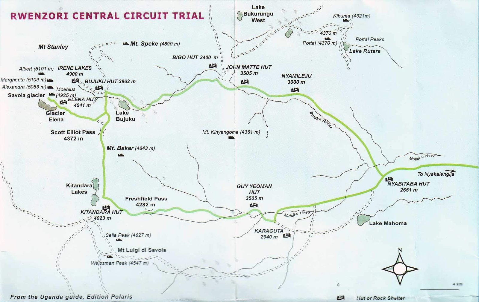
The historic, classic loop pioneered by early explorers. This map details the progression of mountain huts (Nyabitaba, John Matte, Bujuku, Elena, Kitandara, and Guy Yeoman) and the approach to Margherita Peak via the Scott Elliot Pass.
The Bukurungu Wilderness Trail
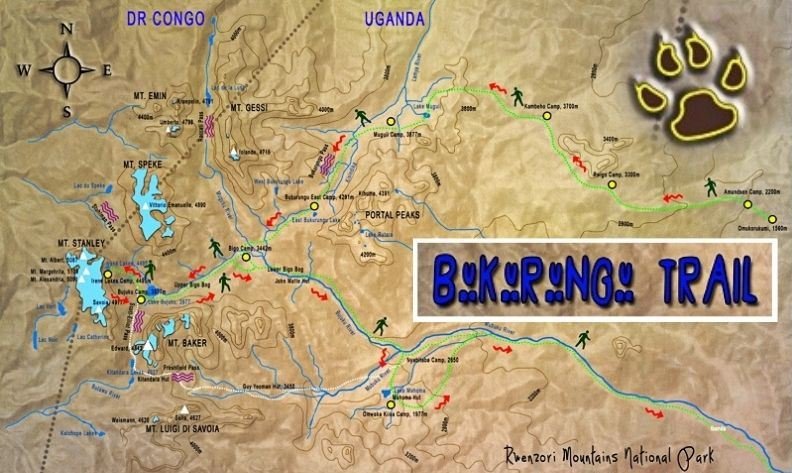
A wilder, more remote alternative to the Central Circuit. This map illustrates the northern approach, bypassing the Bigo Bogs and highlighting the stunning high-altitude lake systems (Lake Mughuli, Lake Bukurungu) leading to Mount Stanley.
The National Park Boundary
National Park Overview
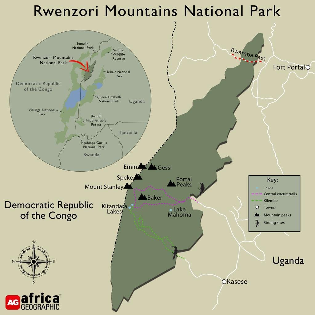
This map provides a macro-view of the Rwenzori Mountains National Park within the Albertine Rift. It shows the park’s positioning along the Uganda/Democratic Republic of the Congo border, its proximity to other major wildlife reserves like Queen Elizabeth N.P., and the layout of the six major mountain massifs running along the spine of the range.
Historical Glacier Extent
The Rwenzori Mountains are one of the few places in Africa to support permanent equatorial glaciers. However, these glaciers are highly sensitive to climate change and have experienced dramatic retreat over the last century.
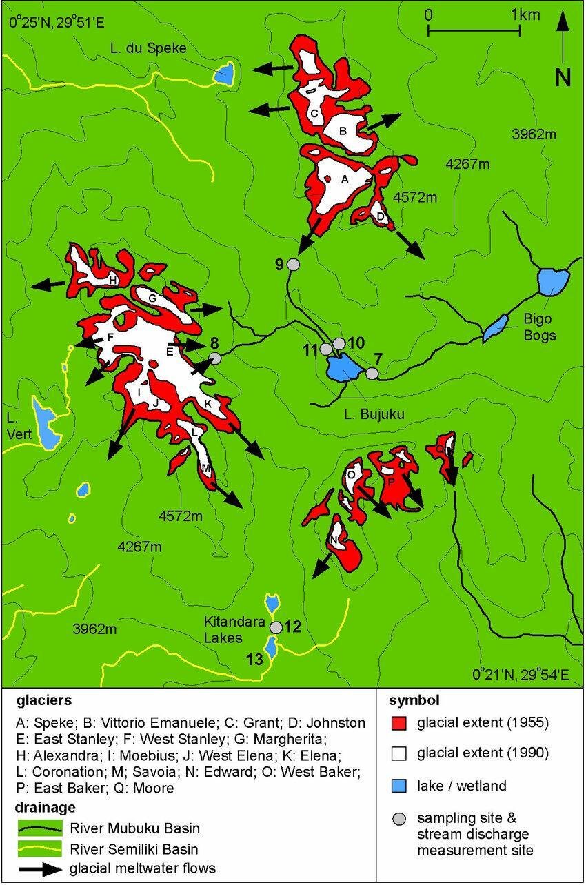
This scientific map documents the shifting glacial boundaries on Mount Stanley, Mount Speke, and Mount Baker. The red areas indicate the massive historical extent of the ice in 1955, contrasted against the significantly smaller white areas indicating the ice pack measured in 1990.
Click the map to enlarge and study the specific glacier zones, including the Margherita and Savoia glaciers.